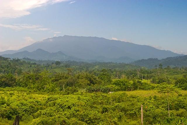
At 2,085 metres, Mt. Mantalingahan is Palawan's highest peak, and its range forms the core of the Mt. Mantalingahan Protected Landscape, declared under the National Integrated Protected Areas System in 2009 and spanning the towns of Rizal, Quezon, Bataraza, Brooke's Point and Sofronio Espanola.
The protected landscape shelters mossy forest, pitcher plants and wildlife found only on Palawan, and its slopes feed rivers used by farming communities across the province's south.
Reaching the summit is a serious multi-day trek, typically four days, starting from Barangay Ransang in Rizal and exiting near Brooke's Point, with DENR and barangay permits required and a local guide mandatory.
- Best time
- November to April, outside the June to October wet season
- Getting there
- By van from Puerto Princesa city to Rizal town, then on to the jump-off at Barangay Ransang for the multi-day trek
- Nearest gateway
- Puerto Princesa International Airport
- Where
- 8.818° N, 117.670° EOpen in Google Maps
Mt. Mantalingahan Protected Landscape and Rizal
Keep scrolling and they travel past. Press one to see it whole.
Rizal, the town
Rizal is a coastal town of southern Palawan on the South China Sea side, 203 km from Puerto Princesa, with its seat at Punta Baja. Part of Mt. Mantalingahan Protected Landscape lies within it.
In the Singnapan Valley, in Barangay Ransang, charcoal petrographs drawn on cave walls are counted among the most important ancient paintings in the country.
Getting to Rizal
- From Puerto Princesa
- By road, about 203 km.
The local government
- Mayor
- Norman Ong
- Vice mayor
- Maria Gracia Zapanta
- Municipality of
- Rizal
- PSGC code
- 1705323000
- Barangays
- 11
- Land area
- 1,256.5 km²
Elected on 12 May 2025 for the term to 30 June 2028, named as on the ballot, from the count COMELEC released (via Rappler); checked 9 November 2026. An official can be suspended or replaced during a term, so the town hall has the last word.
In an emergency
Call 911Rizal’s disaster office (MDRRMO): 0999-993-8869, 0946-430-7442
From the provincial emergency page, checked 8 November 2026. Every emergency number
Its people and its past
The area, once Tarumpitao Point in the municipality of Quezon, became a separate town on 14 April 1983 under the name Marcos. Republic Act No. 6652 of 1987 renamed it the Municipality of Dr. Jose P. Rizal.
The Tau't Bato are among the town's peoples; some of their communities in the Singnapan Valley live in caves during the rainy season.
Also around Rizal
heritage
Singnapan Valley
A valley in Barangay Ransang where the Tau't Bato people live, known for charcoal-drawn cave petrographs whose date has yet to be scientifically established.
Rizal, Palawan - Wikipedia